It was fast but it was nice. We did a mapping of approximately 20Ha in the area of Surabaya this october. The project included the data acquisition by lidar and photogrammetry.
Continue readingDiscover our projects
It was fast but it was nice. We did a mapping of approximately 20Ha in the area of Surabaya this october. The project included the data acquisition by lidar and photogrammetry.
Continue reading
Another project successfully completed in record time. We were fortunate to be commissioned for a 25Km corridor mapping by Lidar and photogrammetry.
Continue reading
With the aim of rebuilding a hotel from zeros, we intervened in Ubud to establish a 3D plan of a land with existing facilities and buildings…
Continue reading
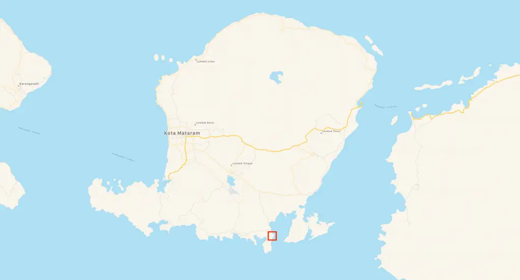
Another example where the border between work and pleasure does not exist. The MSDI team recently conducted a 3D photogrammetric mapping mission to Gili Asahan Island, located southwest of Lombok
Continue reading
Another project successfully completed! We have just finalized a lidar mapping of 1100Ha in the Babulu region, a few kilometers from Balikpapan, located in the South-East of Kalimantan (Borneo).
Continue reading

Archeology researchers love lidar data because it allows details that are almost impossible to see with the naked eye, let alone stay on the ground.
Continue reading