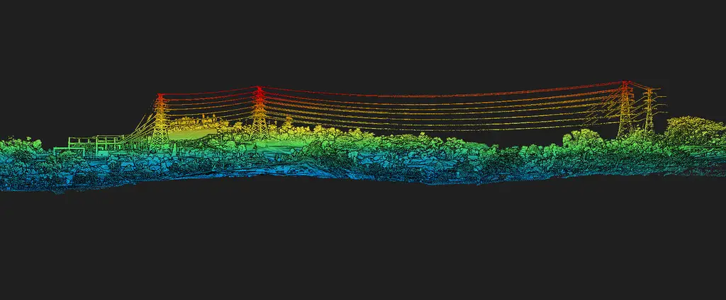
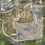
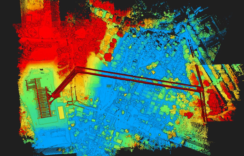
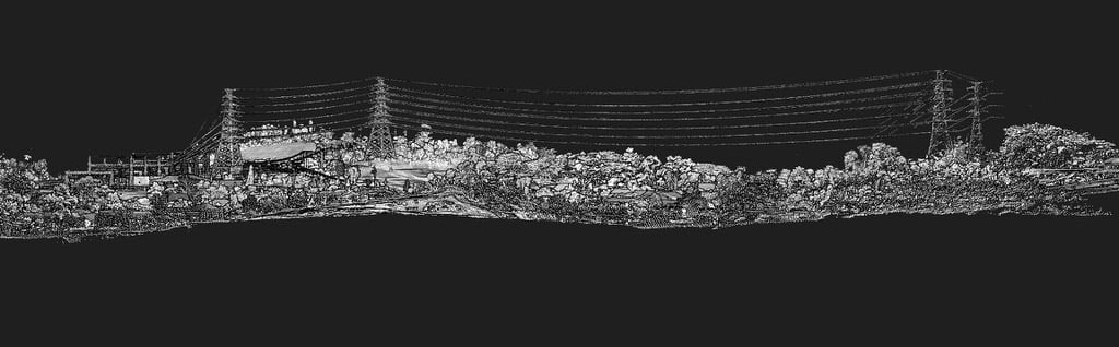
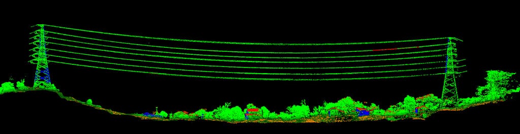
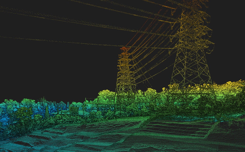
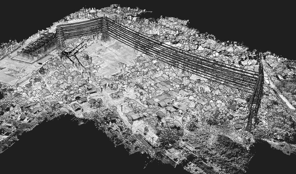
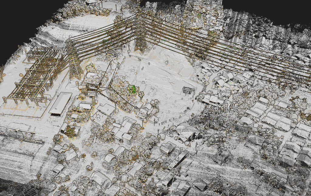
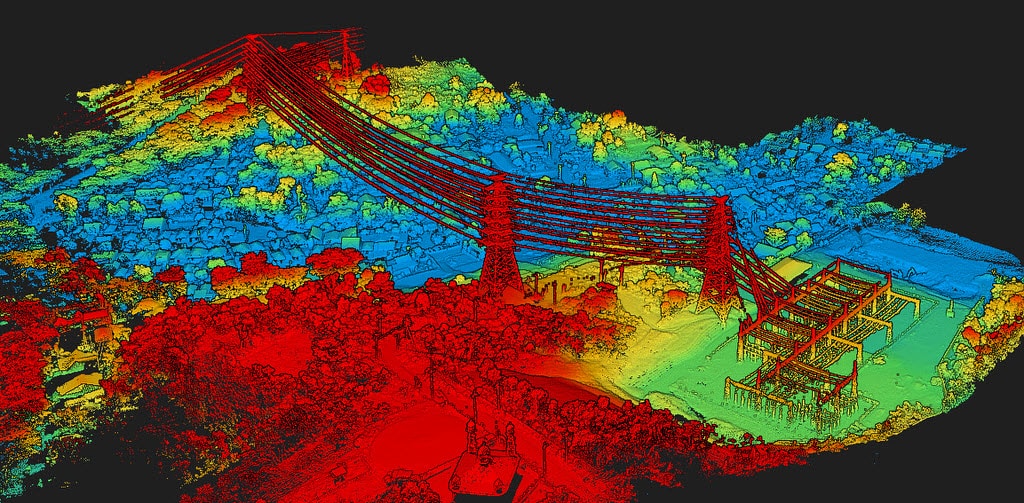
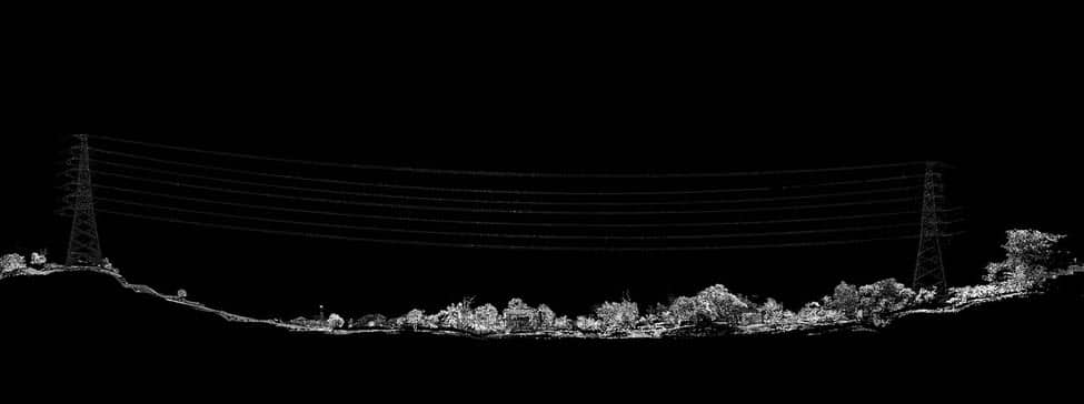
MSDI offers corridor mapping services for high voltage lines, city electrical network, transmission towers, railroads. Thanks to our aerial power line survey services, it becomes easy to carry out proactive maintenance on the installations and thus avoid any interruption of service due to natural conditions. Lidar services can show the dangers associated with vegetation that is too close to high voltage lines.
Vectorization and conversion on plan.
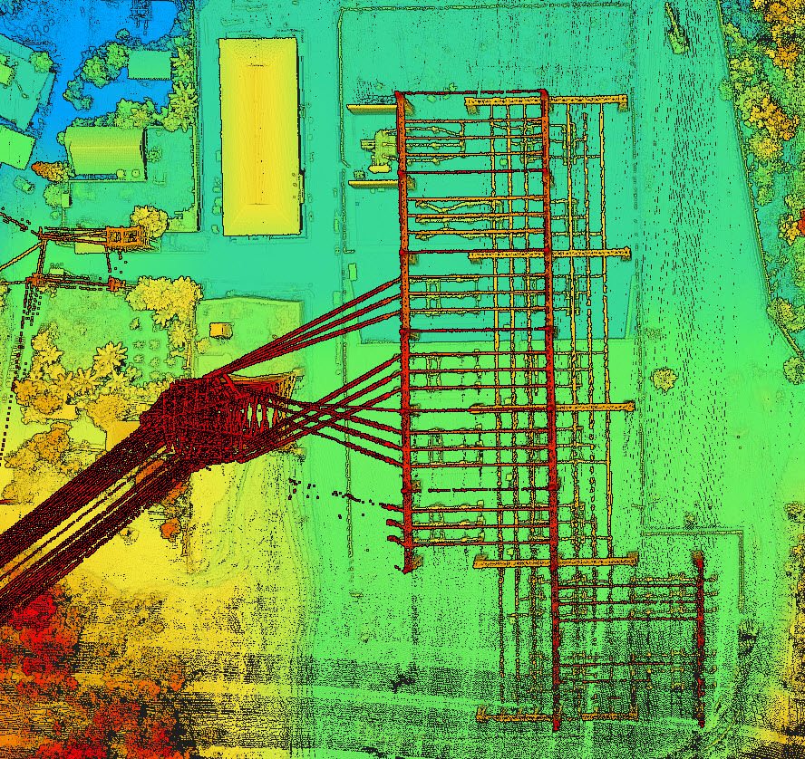
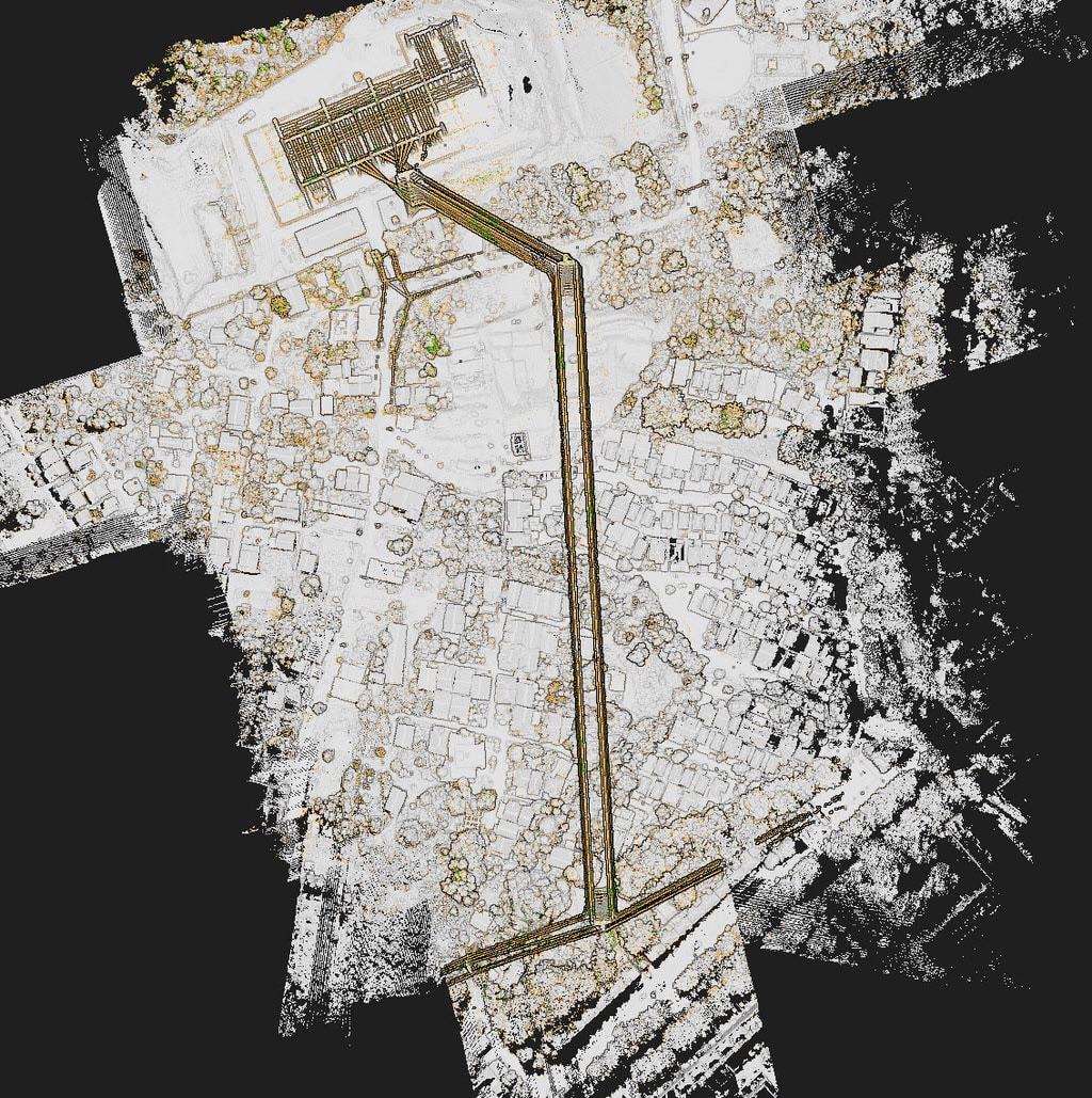
Our ultra-precise lidar is capable of detecting power lines and thanks to our post-processing we can generate vectorized plans of installations, pylons, power lines which can then be imported into your professional software such as autocad, ESRI arcgis and much others.
After detection, the wires are drawn into vector lines that can be used in Autocad
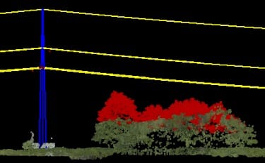
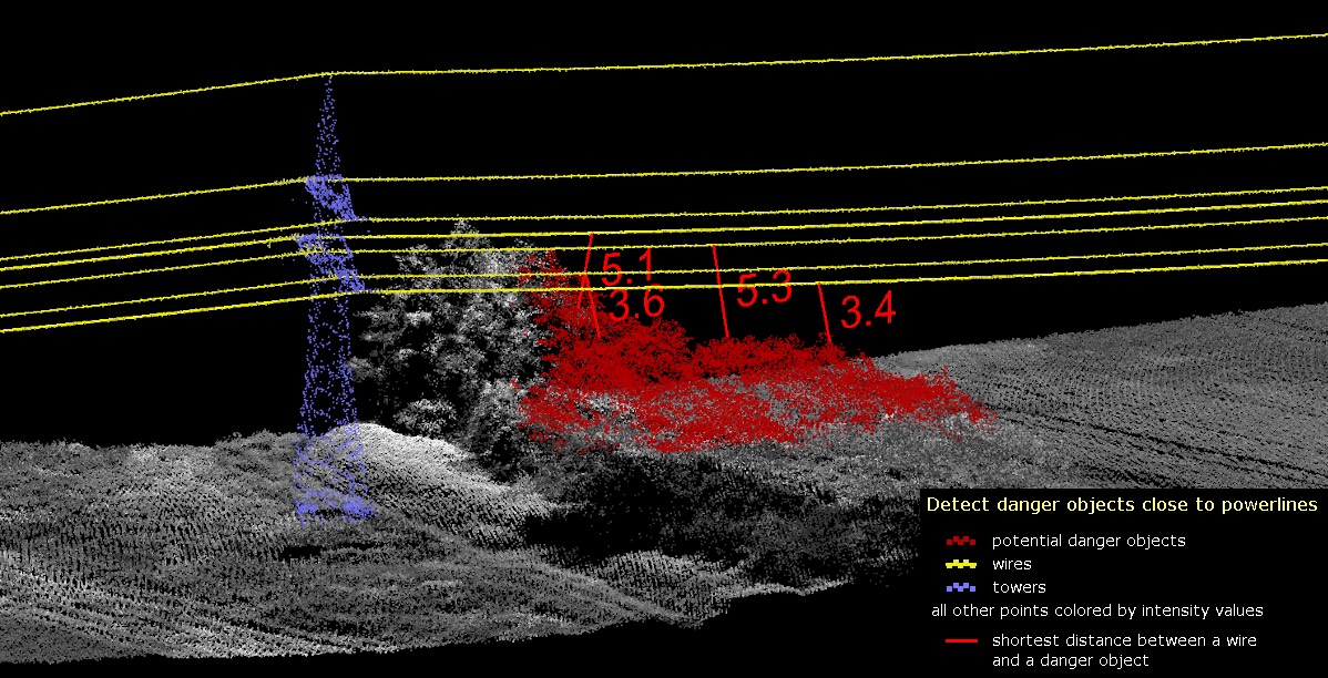
Danger detection
Vegetation and tree growth is the main cause of damage and incidents on power lines and railways. In addition to vectorizing the lines, our solutions make it possible to highlight areas at risk where the vegetation risks disturbing and damaging the installations. Power outages can quickly cost a lot of money and put people and society at risk, as well as public health facilities such as hospitals. It is therefore important to keep the network in good condition by targeting the risks thanks to our solutions and according to our reports, intervene quickly and efficiently.
DELIVERY FORMATS
- .dwg (AutoCAD)
- .dxf (Drawing exchange)
- .shp (ESRI)
- .las (Autocad Civil, Globalmapper)
- .tiff (google earth, autocad civil, ESRI, globalmapper and more…)


