
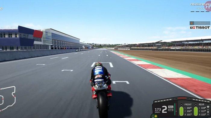
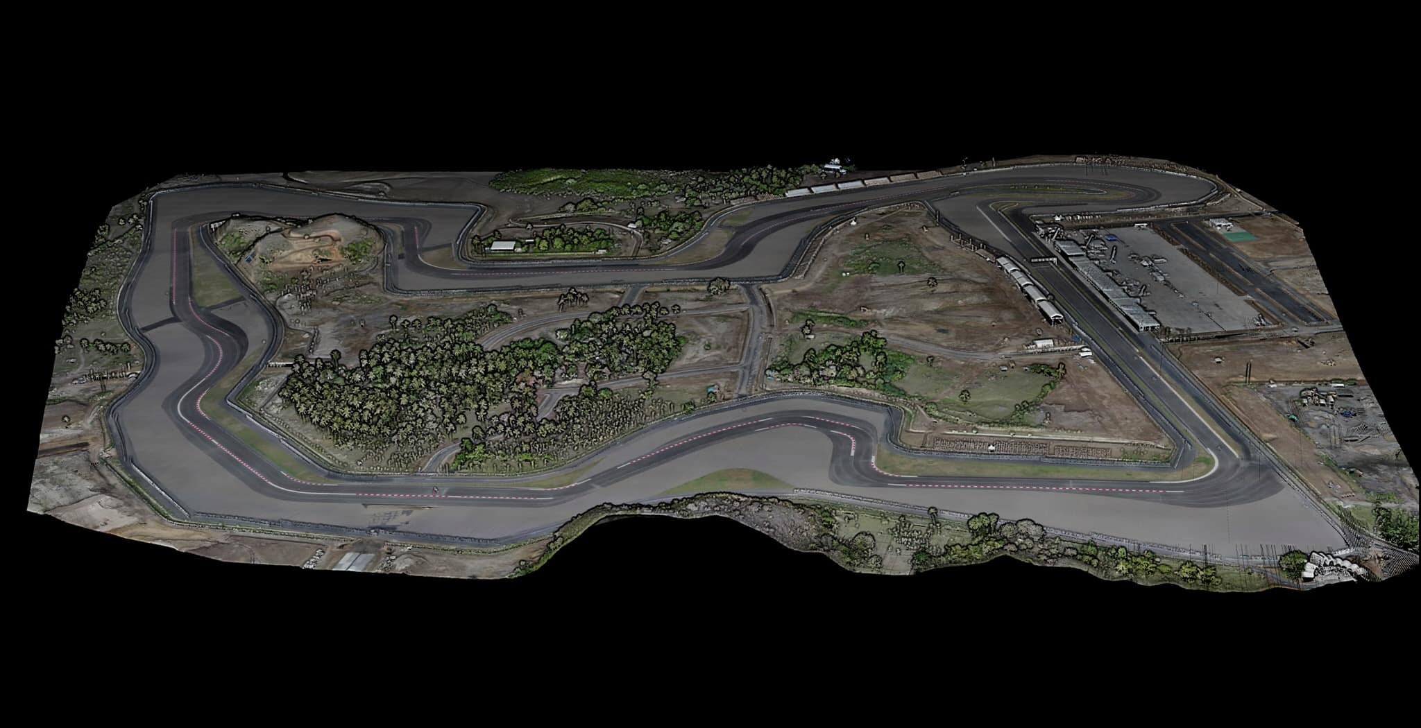
Video games are becoming more and more sophisticated and development studios are pushing realism even further thanks to new technologies and ever more powerful game consoles over the years. This is why the challenge of our project, for the development studio Milestone, was to create a ‘digital twin’ of the new Mandalika circuit, located in Lombok in Indonesia, as precise as possible, to provide a gaming experience even more realistic than ever, even realism to the centimeter!
Client
Milestone – Video Game development studio
WHAT WE DID
3D LiDAR, photogrammetry, 360 degres photos.
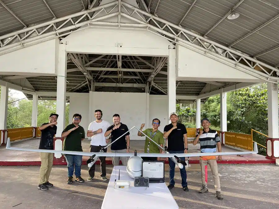
The Milestone company contacted us in September 2021 to carry out a topographical survey as well as the acquisition of different contents with the aim of integrating the new circuit into the new version of the MotoGP 22 game. In view of the originality of the project and the the precision required, we therefore immediately offered the studio a lidar acquisition in addition to photogrammetry to capture every detail of the terrain and the environment. To have accurate color rendition, we had to do all of the photogrammetry in less than an hour to avoid changes in shadow or light that can impact color temperature. We have therefore separated the lidar and photogrammetric acquisition on two different drones, an inspire 2 equipped with an X5S camera and a matrix 600 pro which will carry out the lidar acquisition with our Yellowscan VX15 sensor. This combination is perfect because we can safely make the lidar drone fly slower to have better point cloud density.
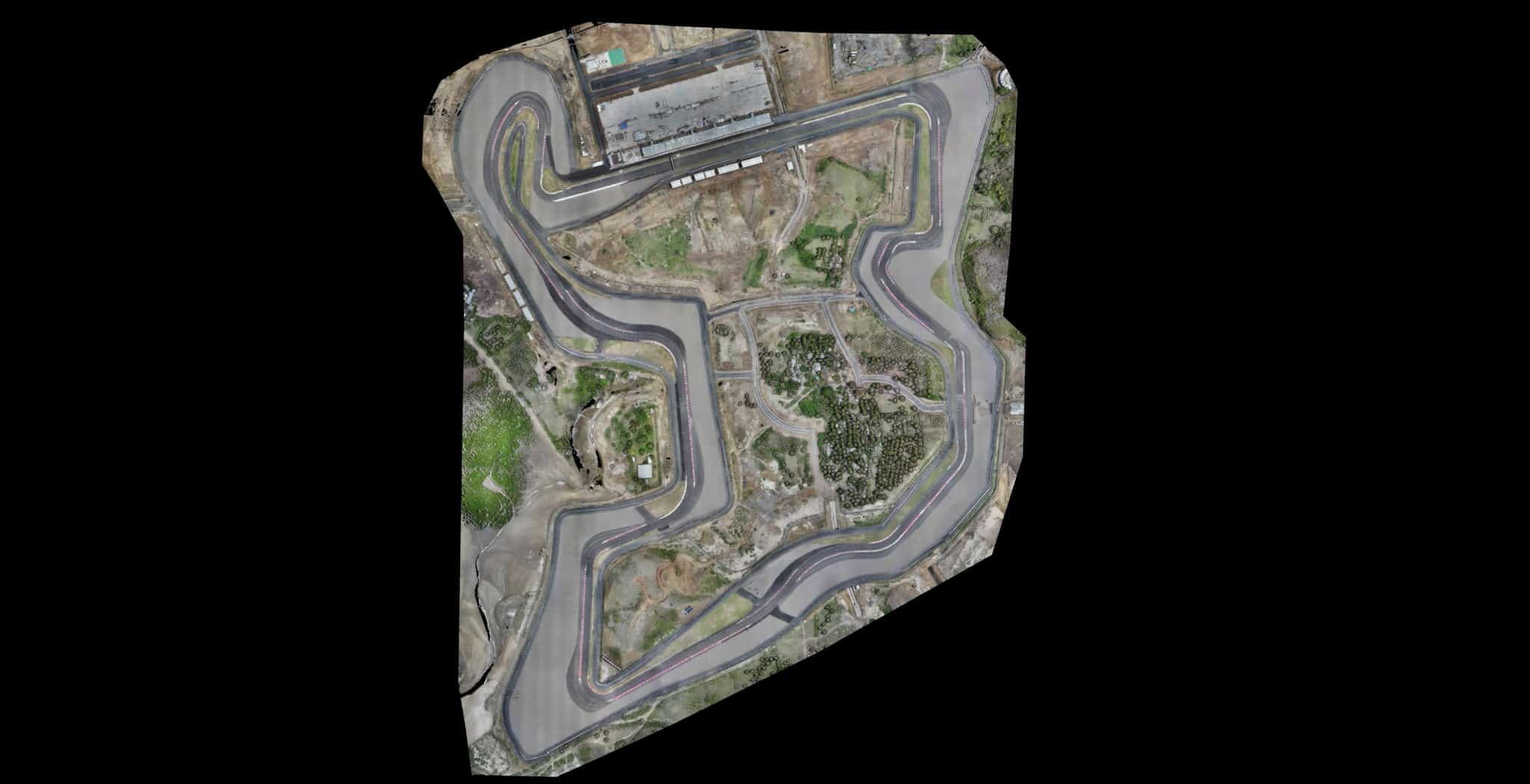
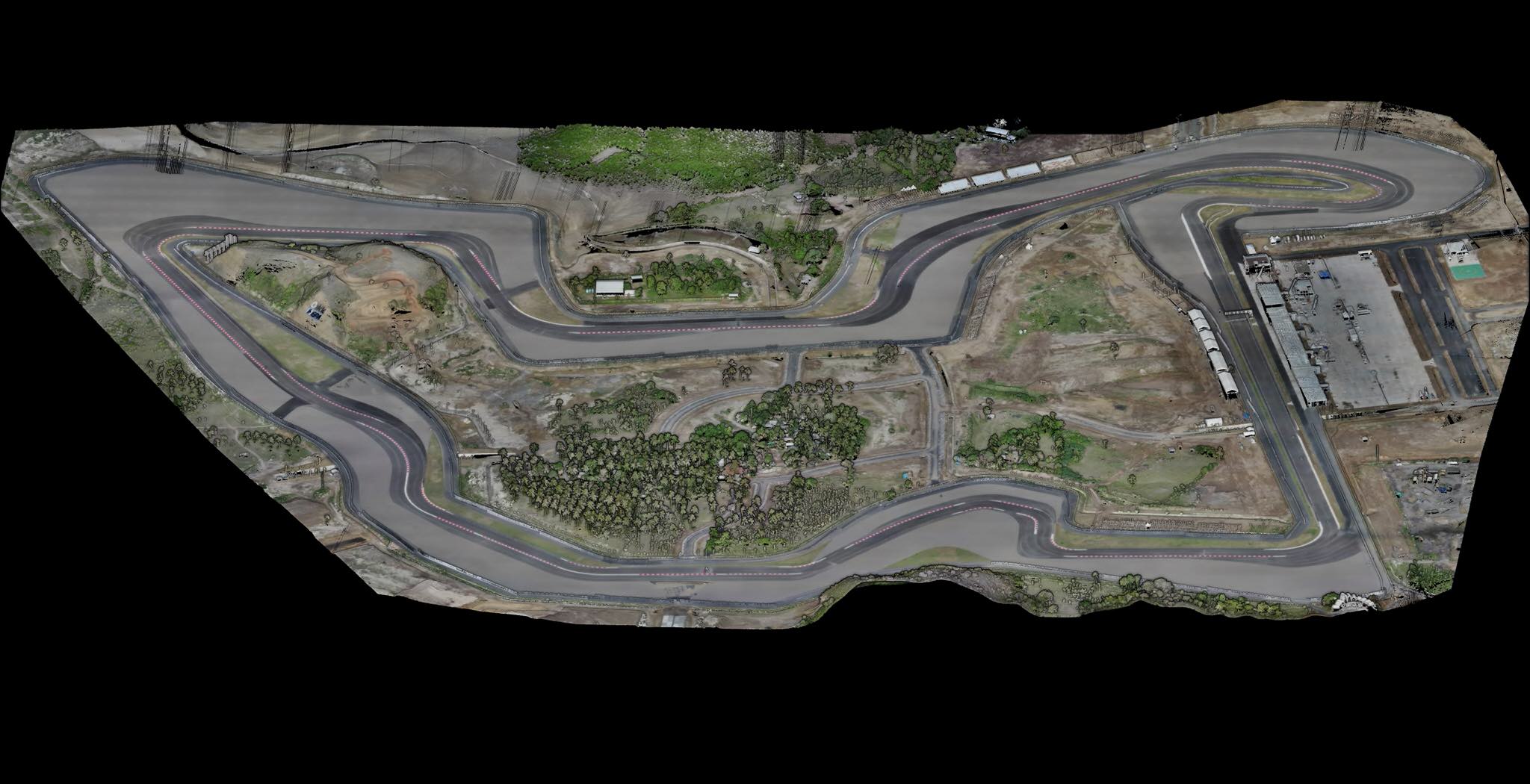
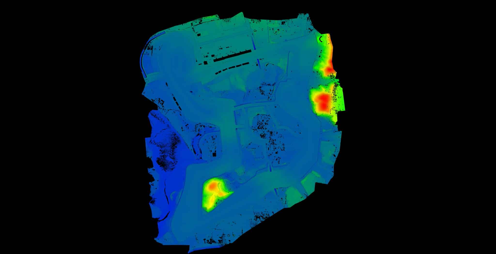
The Mandalika circuit covers 120 hectares and it took us only 3 flights of 12 minutes to capture the entire site with a high point density. For this we flew at a speed of 6 meters / second at 65-70 meters altitude and an interline distance of 110 meters. The use of 7 GCPs on the ground allowed us to match the two data-sets: photogrammetry and Lidar. For a simulation game every detail counts to transcribe the most faithfully the conditions of reality, thus, using high precision equipment makes it possible to detect each variation of the asphalt on the track and also to measure the angle of inclination of the track which will have an impact on the handling and grip of the motorcycles, but also which will be able to give real data on the runoff and the accumulation of water in certain zones, in the event of simulation of heavy rains, to increase the difficulty of piloting.

Thanks to lidar data, the company Milestone announced that this circuit will be one of the best assets in the game and a first for the company, which had never had the opportunity to test this technology before. We also carried out multiple photo acquisition, 360 degree panoramas and video on the ground, to have the details of the buildings and all other interesting details/objects to integrate into the game.

