LiDAR Mapping ServicesLong Range and high precision survey
Our LiDAR Services
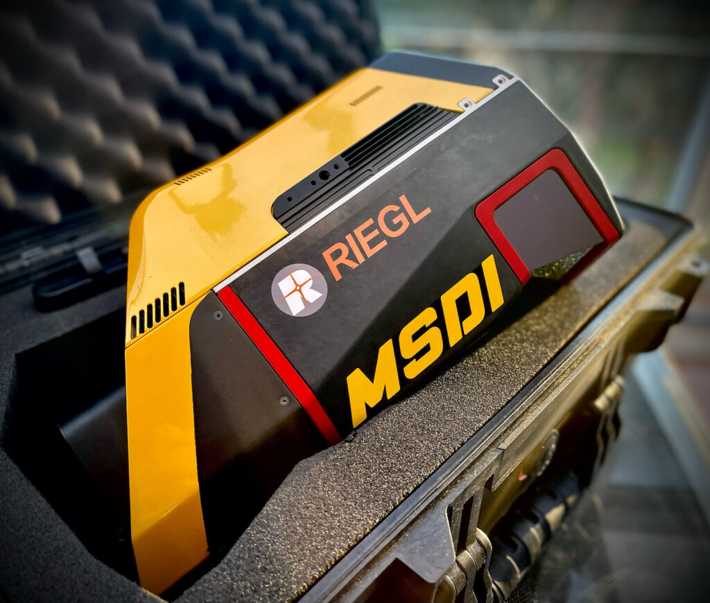
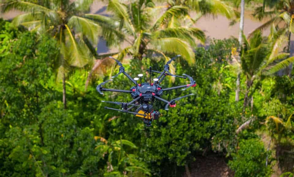
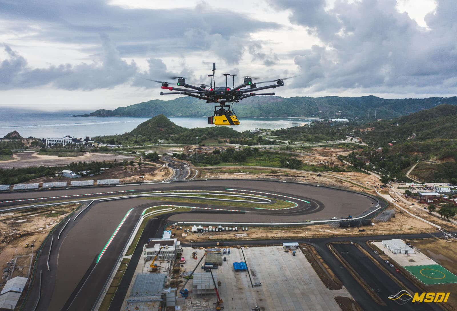
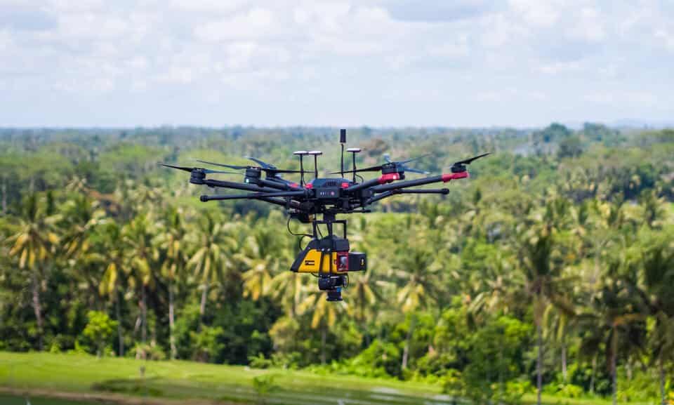
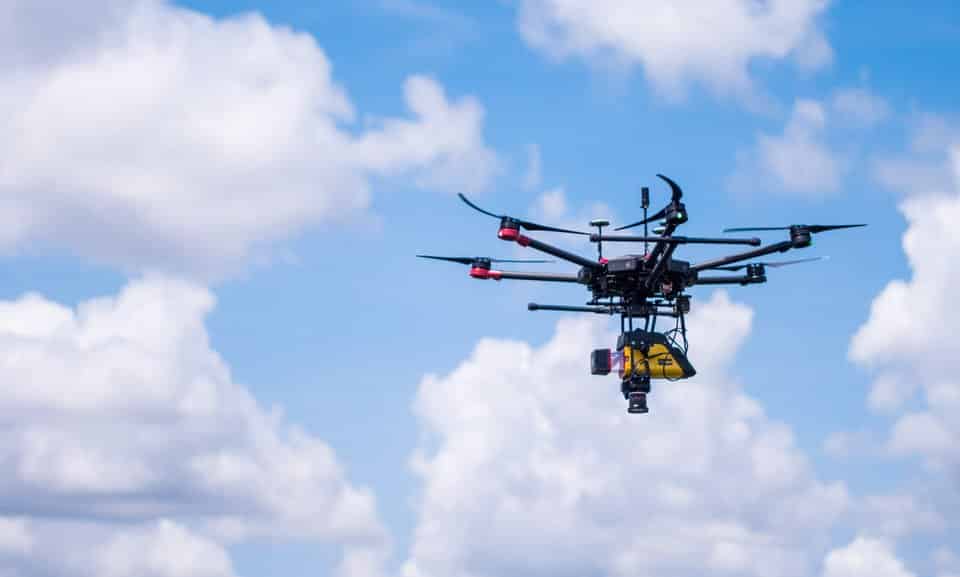
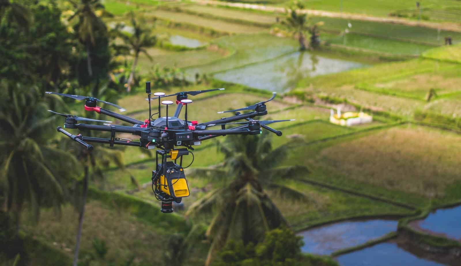
MSDI is excited to introduce our cutting-edge drone LiDAR survey services in Indonesia, Asia, and anywhere where your projects will bring us around the world… We offer state-of-the-art aerial topographic solutions with high precision, survey-grade data collection using UAVs (Unmanned Aerial Vehicles) for a diverse range of industries, including:
- Mining
- Oil & Gas
- Forest Management
- Civil Engineering
- Real Estate Development
- Archaeology
- Corridor Monitoring
- Scientific Exploration
- And many more…
Our drones come equipped with the latest 3D laser scanning technology, ensuring reliable and accurate data to support the success of your projects. Trust MSDI to provide comprehensive and innovative LiDAR solutions tailored to your unique needs.
What is the LiDAR and how it works?
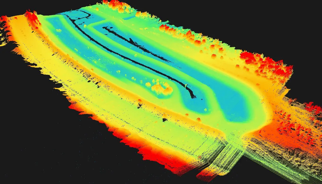
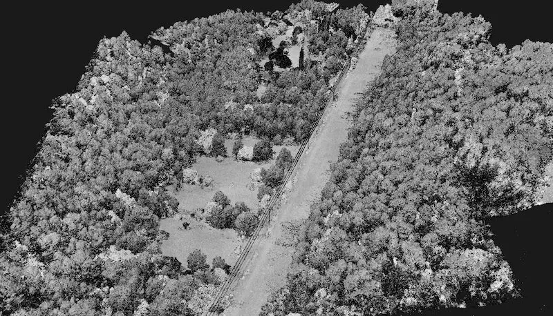
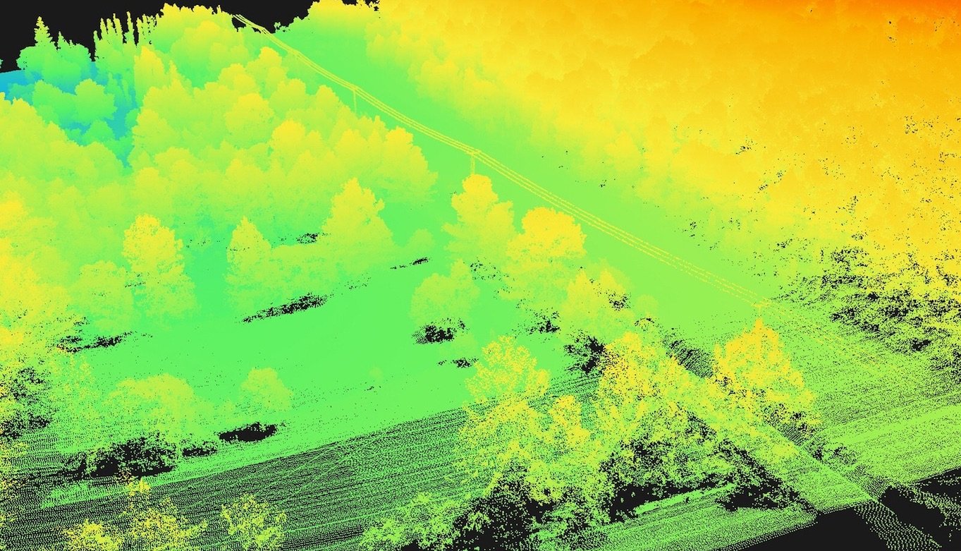
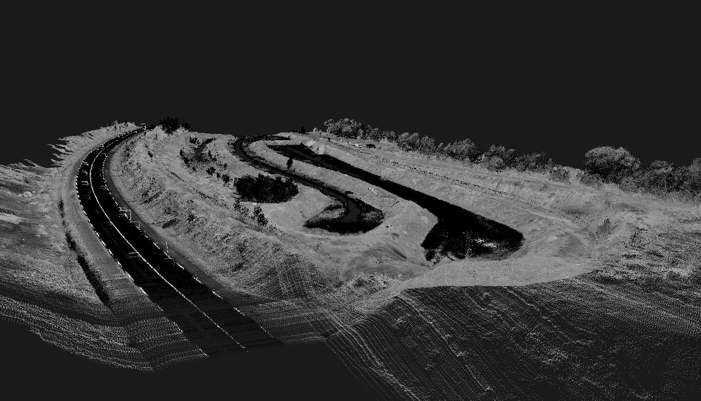
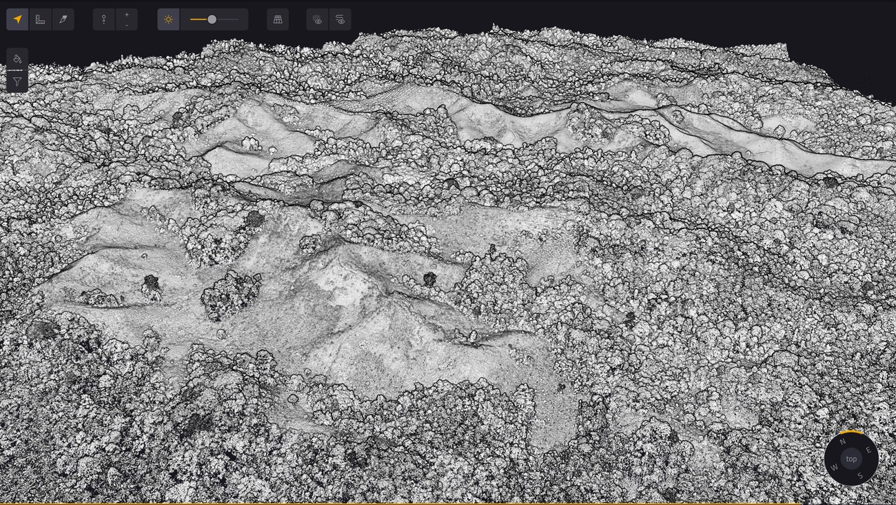
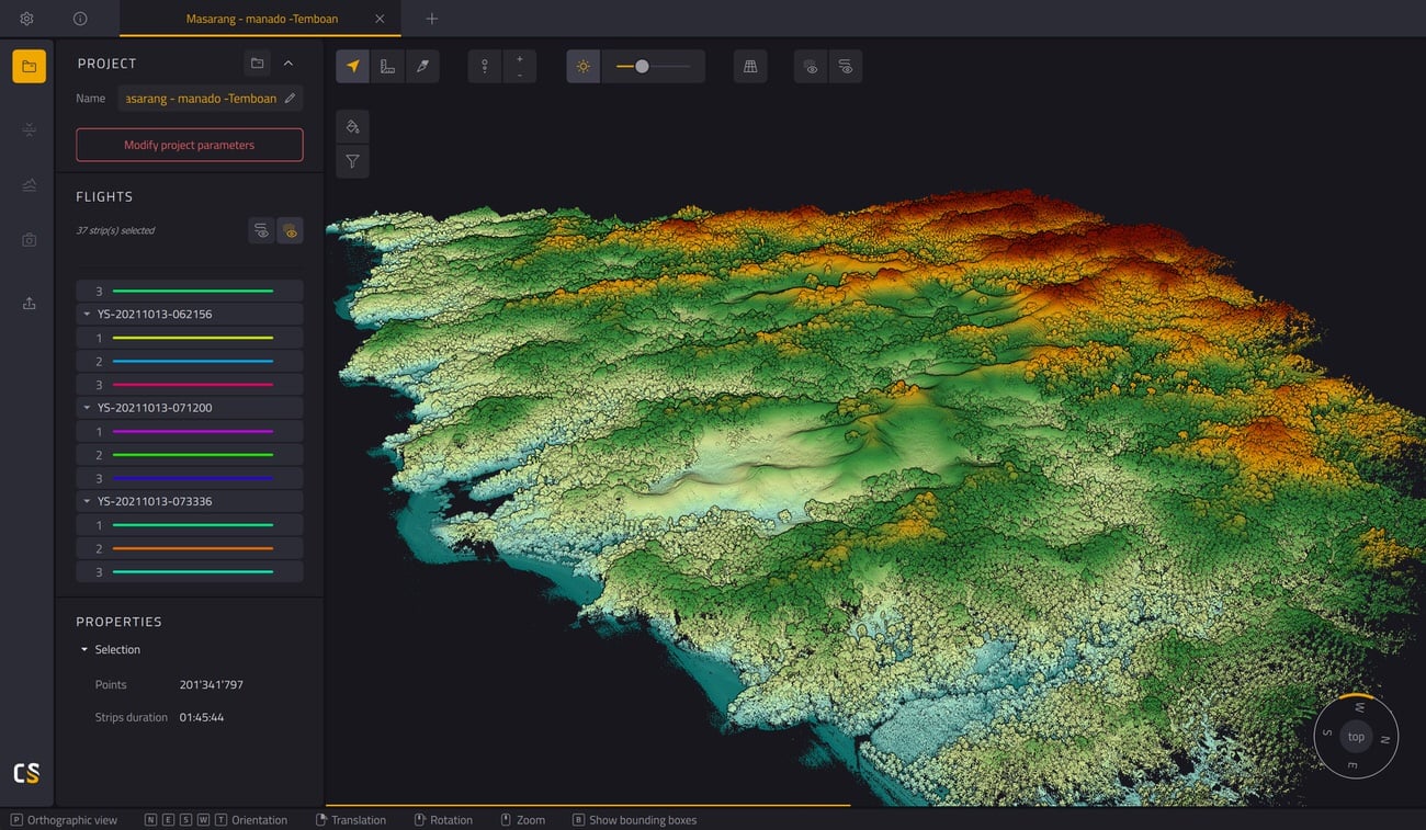
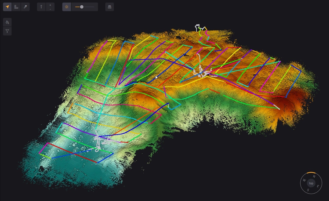
LiDAR for Light Detection and Ranging, it is an assembly of different modules capable of emitting a light (laser) and measuring its variations when it encounters an obstacle. These variations are transcribed into points that can be classified and represent at the end a point cloud that will be a 3D representation of our environment.
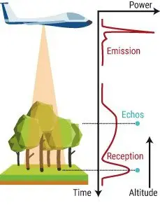
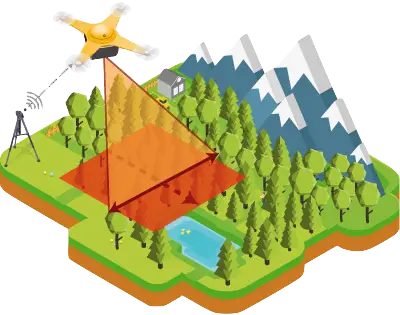
To perform the mapping, we will grid the area with our drones, above a defined perimeter. During the flight, the laser raises more than 100,000 points per second and is able to pierce the vegetation to reach the ground. Our drones and LiDAR are synchronized with an RTK GNSS Base Station who sends the GPS correction in real-time to keep a centimetric accuracy. In some cases, we process the GPS correction in post-flight using PPK technology.
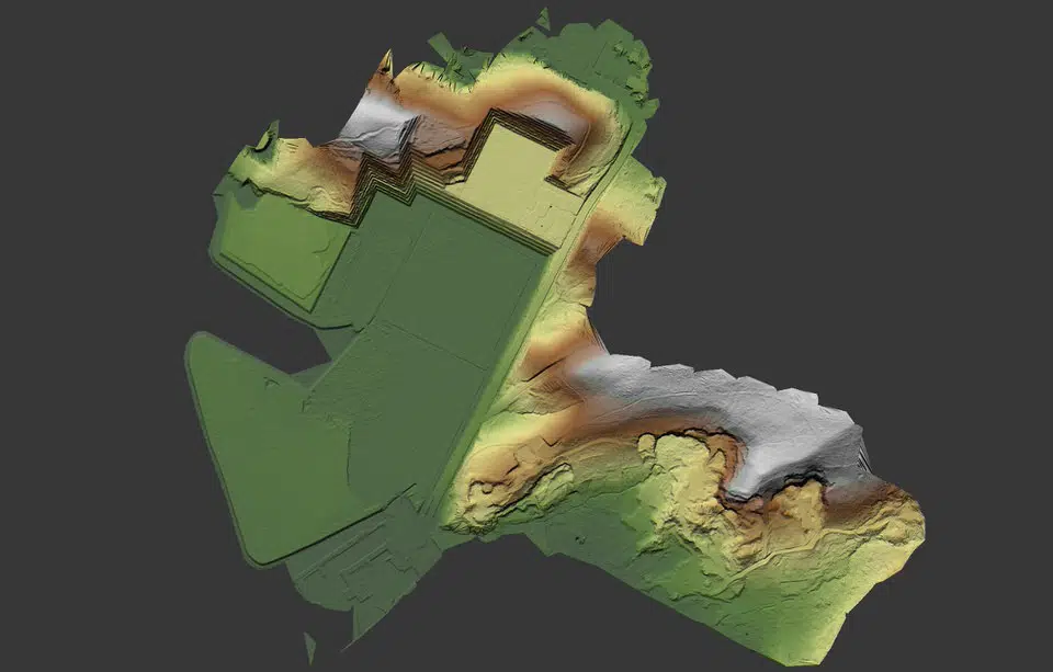
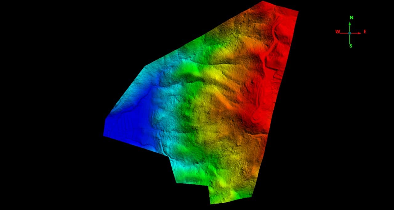
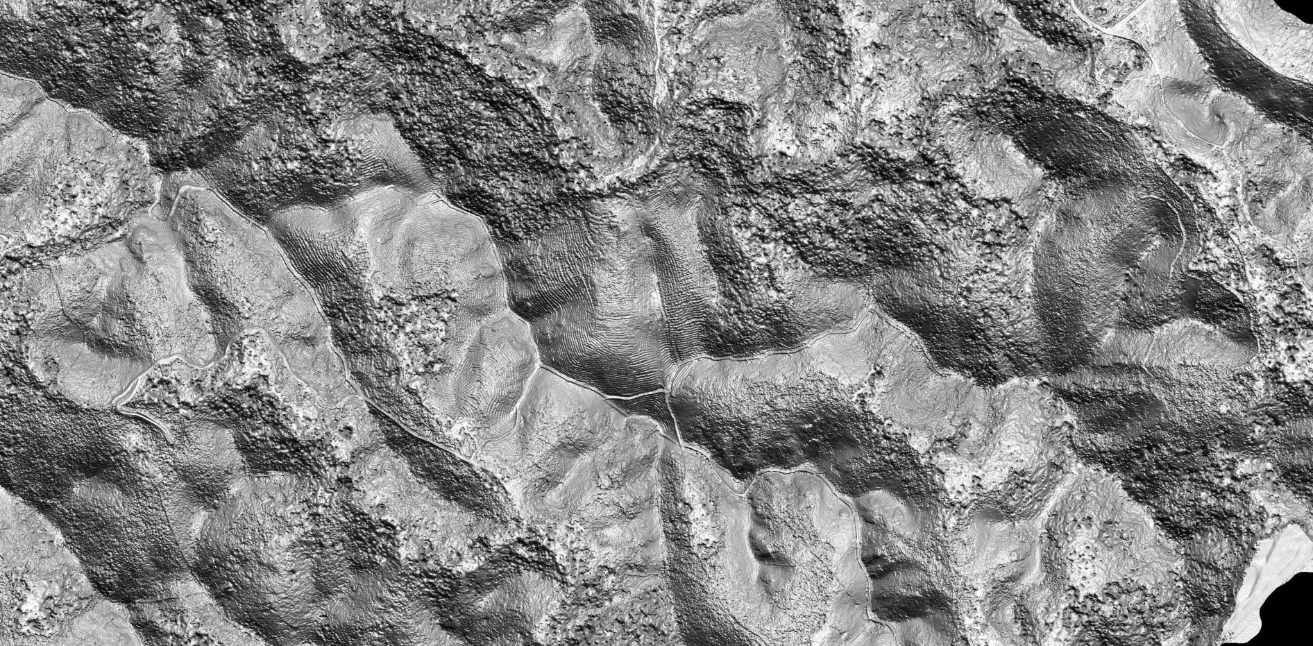
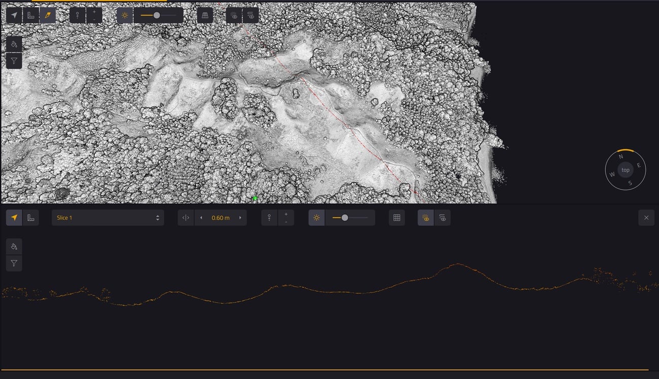
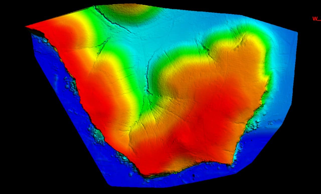
With this method, we can generate Digital Elevation Model (DEM) and also Digital Terrain Model (DTM) because the laser and our software are able to classify the readings to make them appear only in some object classes in post-processing, like trees or buildings for example.
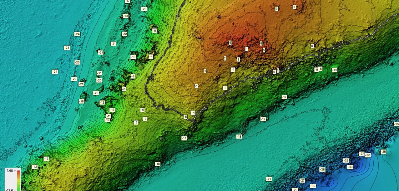
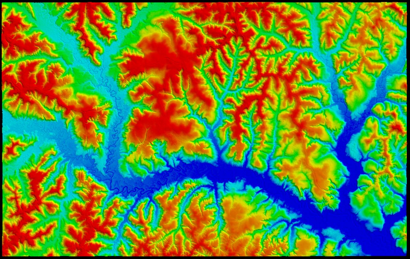
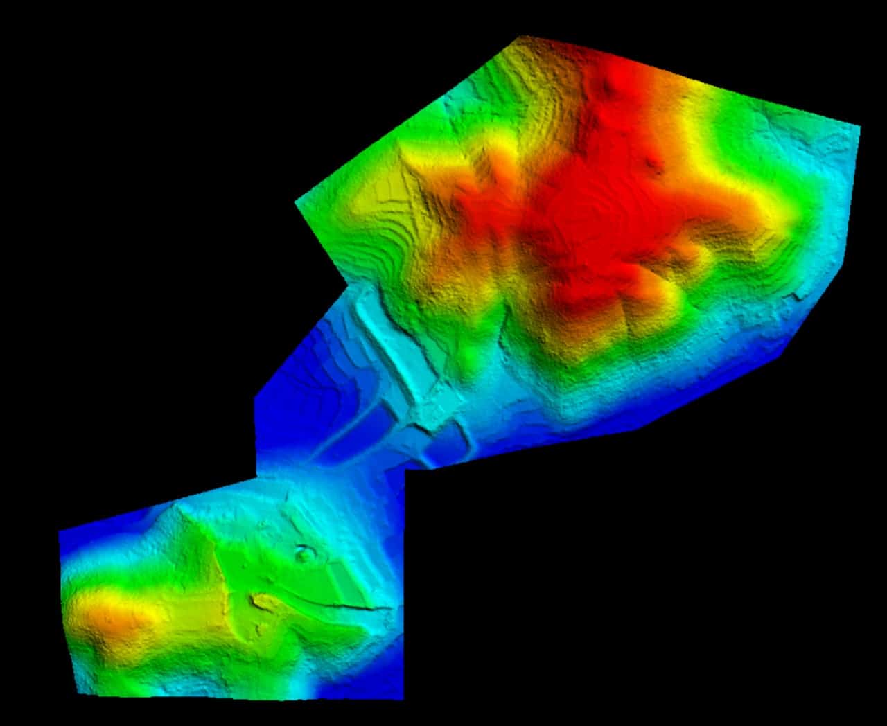
A Digital Surface Model (DSM) and Digital Terrain Model (DTM) are both types of digital elevation models (DEMs), which are representations of the Earth’s surface using elevation data. They are used in various applications, such as remote sensing, GIS, cartography, and environmental and urban planning. However, there are some key differences between the two models:
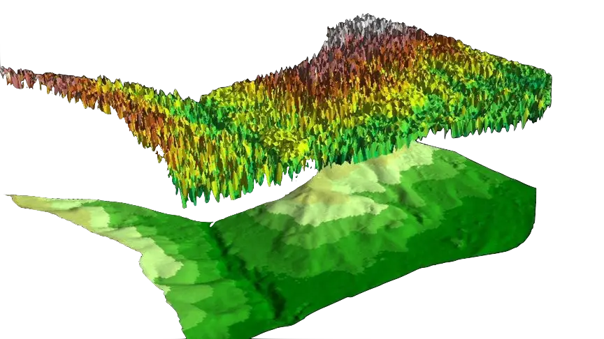
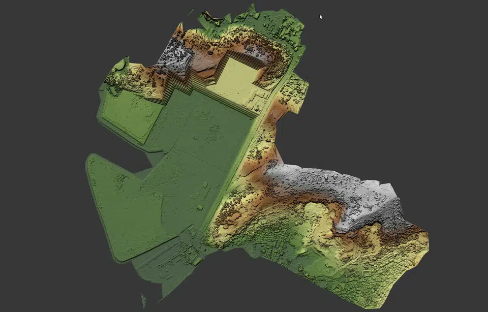
Digital Surface Model (DSM): A DSM represents the elevation of the Earth’s surface, including both natural and man-made features. It includes the heights of buildings, trees, and other objects on the terrain. DSMs are typically created from remote sensing data, such as aerial photographs, satellite imagery, or LiDAR (Light Detection and Ranging). They can be used in applications like urban planning, 3D modeling, telecommunications, and line-of-sight analysis.
Digital Terrain Model (DTM): A DTM, on the other hand, represents the bare ground elevation, removing any above-ground objects like buildings and vegetation. It provides a more accurate representation of the Earth’s surface, focusing on the topography and terrain features such as hills, valleys, and slopes. DTMs are often created by processing DSMs to remove the above-ground objects and interpolate the bare ground elevation. They are used for applications like hydrological modeling, flood risk assessment, land use planning, and geological analysis.
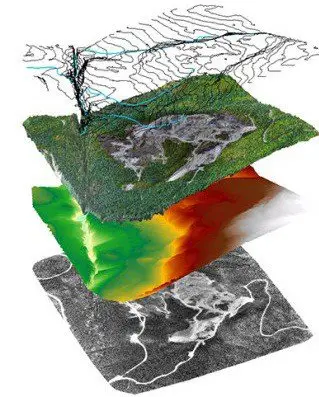
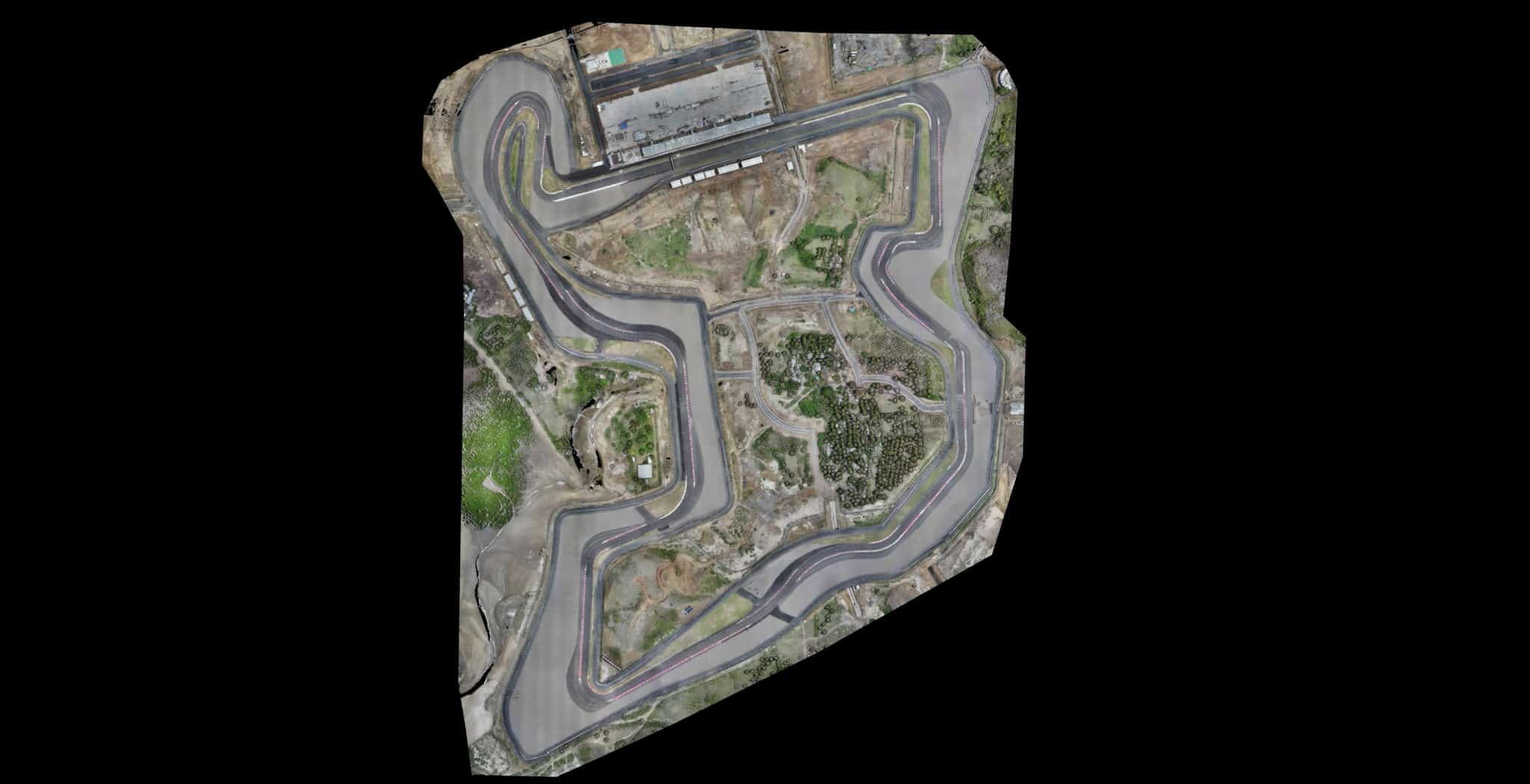
From these point clouds, we can also extract other data, such as contour lines and we can realize orthomosaic plans, thanks to the photos captured during the flight. These data can be integrated into your professional software (GIS and Autocad for example)
For More information or booking please, contact us :
The benefits of using LiDAR technology
Multi layer capabilities
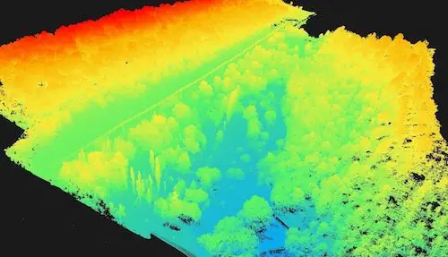
The mapping with UAV LiDAR allows seeing through multiple layers of foliages. With our equipment, we are able to pass 5 layers of foliage because the laser is a certified 5 echo target. So we can see deeper than other LiDAR solutions in Indonesia.
Dense Vegetation
The 3D laser scanner is perfect for density measurement and detailed detection. We can penetrate foliage and plant-life, capturing depth data that are unattainable with traditional surveying and mapping – useful for industries such as Agriculture, Forestry, and Land Management.
Precise & detailed detection
Compared to the airborne LiDAR solution, the UAV solution allows us to fly at low altitudes to capture all the details and detect objects accurately. Valuable for Archaeology, Forestry, Land Management, and Energy & Utilities.
Precise to the centimeter
One of the biggest benefits of LiDAR technology is accuracy and Precision. Our laser has an accuracy of 5cm and a precision of 1cm. So we are able to measure an object to the nearest centimeter and to position it to within 5cm compared to reality.
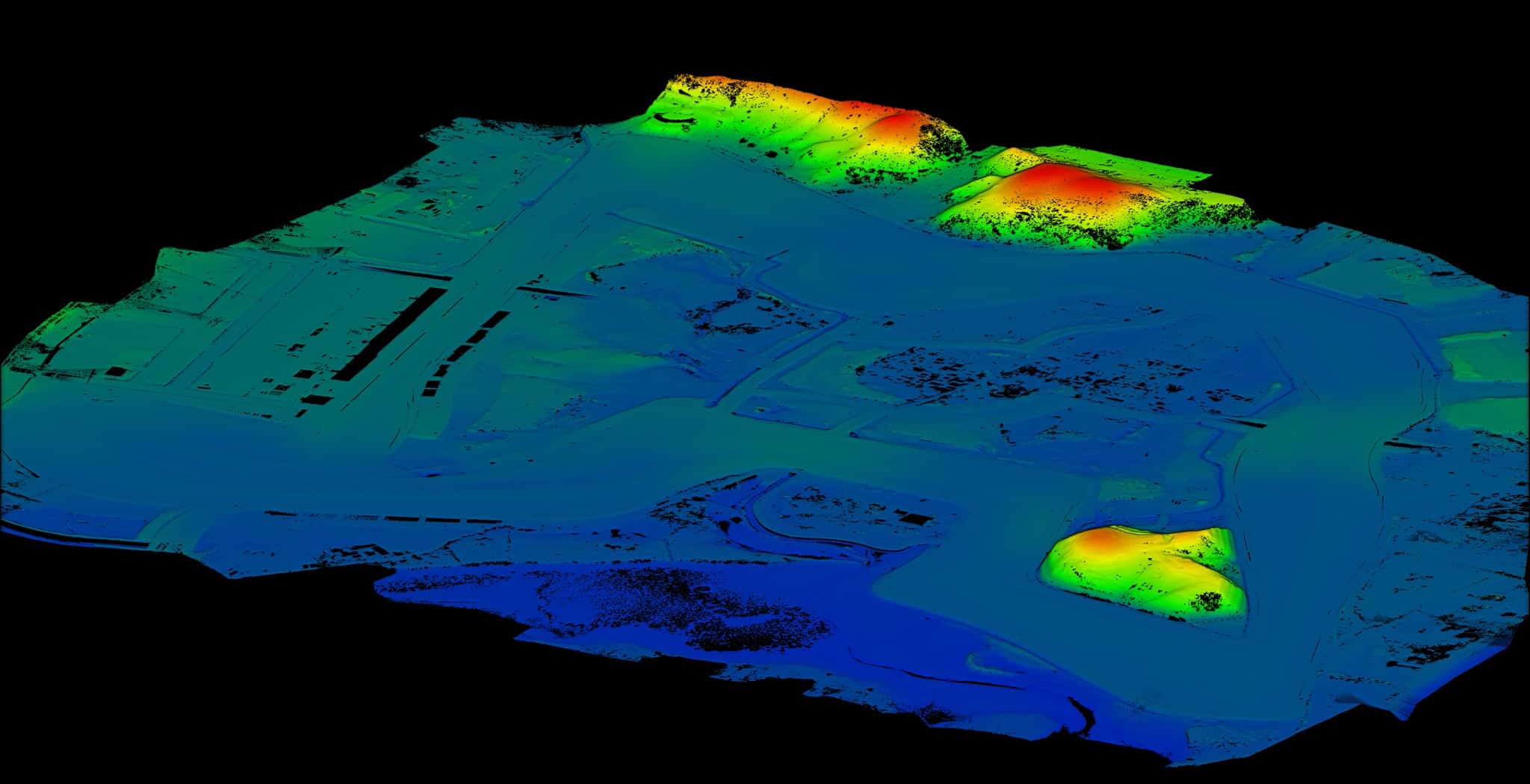
Volumetrics Measurement
Due to high accuracy and highly detailed maps, we are able to measure the volume contained within an area. It's perfect for mining and aggregates stockpiles, dredging, in landfills and industrial sites, or any location where volume measurement is vital.
Elevation Modeling
LiDAR data helps create high-precision 3D models that deliver robust information not possible with traditional surveying. We can extract elevation data and generate contour lines. Useful for many industries, including Civil Engineering, Agriculture, Land Management, and Construction.
Cost-saving
Where mapping by plane and helicopter is expensive, the lidar reduces costs thanks to a lower hourly rate. And because data collection and processing are faster, you save time and therefore money on your project, by reducing the time of your team on the field or waiting for the results.
Faster
Compare to a traditional survey, the Lidar can reduce delays by 30 times. The process is simple: We plan the flight in our offices and carry out the survey in the field using our grid method, the precision data is then processed by our teams on our super-computers. No need to spend days or weeks in the field, the drone takes care of everything, in record time.
Reliable Technology
Year after year the Lidar has already proven itself and is now a safe bet. Thanks to technological advances, this system can now be integrated into drones and is no longer reserved only for aircraft. This technology is now used around the world for all activities that require precision and reliability.
A question ? Contact us now !
Live Streaming
GIS Integration
Example of file output capabilities / data export*
*The list below is given as an indication, some software may be missing, please contact us for more information and to verify that your software will be compatible.
Orthomosaic raster
geoTIFF (.tiff), KML tiles (.png/.kml)
Compatible with
Esri ArcGIS
GlobalMapper
QGIS
Autodesk
DraftSight
GeoMedia
Erdas Imagine
Google Earth
& all leading brands of remote sensing & GIS software
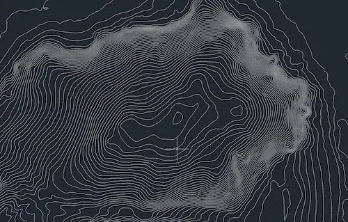
Contours Lines
Shapefile (.shp, .shx), .dxf, .dwg
Compatible with
Esri ArcGIS
GlobalMapper
QGIS
Autodesk
Autocad suite
DraftSight
GeoMedia
Erdas Imagine
& all leading brands GIS software
Point Cloud
.las, .laz, .ply, .ascii
Compatible with
I-Site Studio
Esri ArcGIS
GlobalMapper
Autodesk
Quick Terrain
3DReshaper
Trimble Realworks
Bentley MicroStation
CloudCompare (free)
& all leading brands of survey / 3D scanning software
DSM, DEM, DTM
geoTIFF (.tiff)
Compatible with
Esri ArcGIS
GlobalMapper
QGIS
Quick Terrain
Geomedia
Google Earth
& all leading brands of survey / 3D scanning software