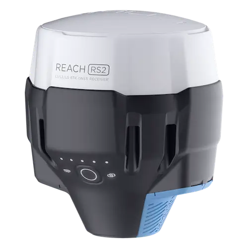
REACH RS2
Rent Multi-band RTK GNSS receiver with centimeter precision
For surveying, mapping and navigation.
Comes with a mobile app
Baseline up to 100 km
Update rate 10 Hz / 5 Hz
Gets a fix in seconds
Reach RS2 gets a fixed solution in just seconds and maintains robust performance even in challenging conditions. Centimeter accuracy can be achieved on distances up to 60 km in RTK, and 100 km in PPK mode.
GPS, GLONASS, BeiDou,
Galileo, and QZSS
L1OF, L2OF, L1C/A, L2C,
E1B/C, E5b, B1I B2I
PPP support
RINEX raw data logs are compatible with PPP services so you can now get centimeter-precise results in any place on Earth. Process RINEX files in an online service and get position with absolute accuracy.
Built-in 3.5G modem
Reach RS2 features a power-efficient 3.5G HSPA modem with 2G fallback and global coverage. Now corrections can be accessed or broadcasted over NTRIP independently, without relying on an Internet connection on your phone.
22 hours on 1 charge
Up to 22 hours of autonomous work when logging data and up to 16 hours as a 3G rover, even in cold weather—no more need to carry spare batteries with you. Reach RS2 can charge from a USB wall charger or a power bank over USB-C.
Key features
- Tracks GPS/QZSS L1C/A, L2C GLONASS L1OF,L2OF BeiDou B1I, B2I Galileo E1-B/C, E5b
- Fast RTK convergence
- Multi-feed antenna with multipath rejection
- 868/915 MHz LoRa modem for up to 8 km connectivity
- 22 hours on 1 charge
- NTRIP and VRS support, works with RTCM3
- Global 3.5G modem
- Logs RINEX at update rate up to 10 Hz
- 16 GB of internal storage
- IP67, water- and dustproof
Mechanical
Dimensions | 126x126x142 mm |
|---|---|
Weight | 950 g |
Operating tº | -20…+65 ºC |
Ingress protection | IP67 (water and dust) |
Electrical
Autonomy | 16 hrs as 3.5G RTK rover
22 hrs logging |
|---|---|
Battery | LiFePO4 6400 mAh, 6.4 V |
External power input | 6–40 V |
Charging | USB Type-C 5 V, 2 A |
Certification | FCC, CE |
Positioning
Static | H: 4 mm + 0.5 ppm
V: 8 mm + 1 ppm |
|---|---|
PPK | H: 5 mm + 0.5 ppm
V: 10 mm + 1 ppm |
RTK | H: 7 mm + 1 ppm
V: 14 mm + 1 ppm |
Convergence time | ~5 s typically |
Connectivity
LoRa radio
Frequency range
Power
Distance |
868/915 MHz
0.1 W
Up to 8 km |
|---|---|
3.5G modem
Regions
Bands
SIM card |
Global
Quad-band, 850/1900,
900/1800 MHz
Nano-SIM |
Wi-Fi | 802.11b/g/n |
Bluetooth | 4.0/2.1 EDR |
Ports | RS-232, USB Type-C |
Electrical
Corrections | NTRIP, VRS, RTCM3 |
|---|---|
Position output | NMEA, LLH/XYZ |
Data logging | RINEX with events
with update rate up to 10 Hz |
Internal storage | 16 GB
160+ days of logging at 1 Hz |
GNSS
Signal tracked | GPS/QZSS L1C/A, L2C
GLONASS L1OF, L2OF
BeiDou B1I, B2I
Galileo E1-B/C, E5b |
|---|---|
Number of channels | 184 |
Update rates | 10 Hz GPS / 5 Hz GNSS |
IMU | 9DOF |
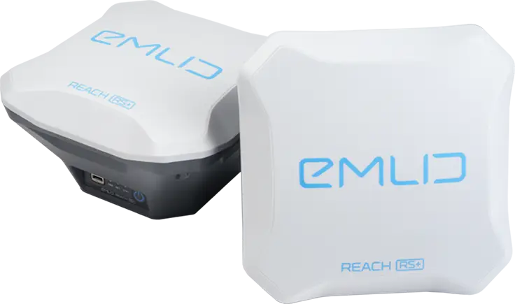
REACH RS+
Rent Single-band RTK GNSS receiver with centimeter precision
For surveying, mapping and navigation.
Comes with a mobile app

Reach RS+ is designed for harsh conditions. Dense forests, mountains, frost, heat and water, Reach can handle them all
IP67
Can be held 1 meter deep underwater for half an hour.
-20ºС…+65ºС
Working temperature. Isn’t afraid of either heat or cold.
30 hours
Industrial LiFePO4 battery that doesn’t die of cold. Can charge over USB from a power bank.

NTRIP or another Reach as a base station
Reach RS+ needs a base station as a source of corrections. That’s a requirement for centimeter accuracy in RTK and PPK. The base might be either another Reach RS+ receiver or an NTRIP service. VRS is also supported.
Reach RS+ works seamlessly with other Reach receivers over any link.
Input and output corrections
Interfaces
TCP, LoRa, Bluetooth, RS-232, NTRIP
Formats
RTCM3
Max distance from a base
Up to 10 km in RTK
20 km in PPK
Mechanical
Dimensions | 145x145x85 mm |
|---|---|
Weight | 690 g |
Operating tº | -20…+65 ºC |
Ingress protection | IP67 (water and dust) |
Electrical
Autonomy | Up to 30 hrs |
|---|---|
Battery | LiFePO4 3.2 V |
External power input | 6–40 V |
Charging | MicroUSB 5 V |
Certification | FCC, CE |
Positioning
Static | H: 5 mm + 1 ppm
V: 10 mm + 2 ppm |
|---|---|
PPK | H: 7 mm + 1 ppm
V: 14 mm + 2 ppm |
RTK | H: 7 mm + 1 ppm
V: 14 mm + 2 ppm |
Connectivity
LoRa radio
Frequency range
Distance |
868/915 MHz
Up to 8 km |
|---|---|
Wi-Fi | 802.11b/g/n |
Bluetooth | 4.0/2.1 EDR |
Ports | RS-232, MicroUSB |
Data
Corrections | NTRIP, RTCM3 |
|---|---|
Position output | NMEA, LLH/XYZ |
Data logging | RINEX with events
with update rate up to 14 Hz |
Internal storage | 8 GB
80+ days of logging at 1 Hz |
GNSS
Signal tracked | GPS/QZSS L1, GLONASS G1 BeiDou B1, Galileo E1, SBAS |
|---|---|
Number of channels | 72 |
Update rates | 14 Hz GPS / 5 Hz GNSS |
IMU | 9DOF |
Surveying with ReachView
The most user-friendly software for data collection that is available both for Android and iOS. With ReachView, you can collect and stake out points and control all the features of Reach receivers, such as setting up a base station, logging RINEX data, and configuring NMEA output.

Point collection: create projects, save points, and export in industry standard formats
Record each position as a point with centimeter precise coordinates. Export projects and open them in GIS or CAD software like AutoCAD, ArcGIS, QGIS, and others.
Formats
DXF, CSV, GeoJSON, ESRI Shapefile

Stakeout: Find points' position on the ground
Stakeout is used to find exact physical locations of points. They can be collected in ReachView or imported from other CAD or GIS software.
Process of stakeout in ReachView has two steps: map view and bulls-eye. Map’s purpose is to help you navigate to points on long distances. When you get closer than 40 cm to the point, bulls-eye turns on to make it easier for you to visually match receiver and point.
Formats
CSV, DXF and GeoJSONs

Logging in RINEX: record raw data, position, and base correction logs
Record raw data, position and base correction logs. Point collection and recording of RAW data are independent processes and can be used simultaneously. ReachView has a simple and intuitive interface for logging configuration and control.
We provide our version of RTKLib for PPK. It’s free and can be downloaded from our docs.
16 GB | 160+ days |
|---|---|
storage | of logging at 1 Hz |
PPP for OPUS
RINEX raw data logs are compatible with PPP services so you can now get centimeter-precise results in any place on Earth. Process RINEX files in an online service and get position with absolute accuracy.
Rental Price
Emlid Reach RS2 / Reach RS+
Days
Weekly
Reach RS2
Rp1,7Mper day (24H)
x1 RS2 receiver + tripod
Dual Frequencies L1/L2/L5
NTRIP compatible
Wifi - Bluetooth - GSM
Mobile App
Full Set
Rp2,8Mper day (24H)
x1 RS+ receiver + tripod
x1 RS2 receiver + tripod
RTK GNSS CM accuracy
NTRIP compatible
Wifi - Bluetooth - GSM
Mobile App
Reach RS+
Rp1,2Mper day (24H)
x1 RS+ receiver + tripod
Single-Band RTK
NTRIP compatible
Wifi & Bluetooth
Mobile App
Reach RS2
Rp6,8Mper week (7Days)
x1 RS2 receiver + tripod
Dual Frequencies L1/L2/L5
NTRIP compatible
Wifi - Bluetooth - GSM
Mobile App
Full Set
Rp11,2Mper week (7Days)
x1 RS+ receiver + tripod
x1 RS2 receiver + tripod
RTK GNSS CM accuracy
NTRIP compatible
Wifi - Bluetooth - GSM
Mobile App
Reach RS+
Rp4,8Mper week (7Days)
x1 RS+ receiver + tripod
Single-Band RTK
NTRIP compatible
Wifi & Bluetooth
Mobile App