
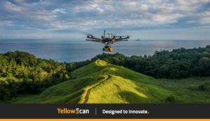
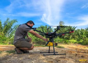
Why we love the lidar systems? Because it makes your job easier !! Look at this map, the algorithm of the software is able to count for you how many trees are present on the map, sort them, and give precise information like height, size, the density of trees on a surface etc… our team will be very happy to work with you on your project so do not hesitate to contact and exchange with us your needs. Our lidar is able to work on forest management, scientific research for the environment, carbon stocktaking, flood analysis and much more…
Contact us to get your personalized quote for your next survey. Https://www.msdi.co.id
#lidar #drone #uav #indonesia #bali #jakarta #kalimantan #3dmapping #survey #topography #yellowscan #vx15 YellowScan #dji #lidarsurveyindonesia #floodanalysis #sciences #forestmanagement #carbonstocktaking RIEGL
Contact us to get your personalized quote for your next survey.
hashtag
#lidar #drone #uav #indonesia #bali #jakarta #kalimantan #3dmapping #survey #topography #yellowscan #vx15 #dji
No comment yet, add your voice below!